Mysterious 'blacked out' island on Google Maps leaves people baffled
Google Maps has a completely 'blacked out' island, and people have come up with all sorts of theories.
Google Maps has mapped out the entire globe, meaning it's packed full of interesting - and often mysterious - things to see.
Houses sometimes appear to be blurred, roads exist that you can't go virtually go down, and apparently islands can be totally blacked out.
Lots of people have become baffled by the strange detail, and naturally, some have been trying to work out exactly why you can't see it.
Advert
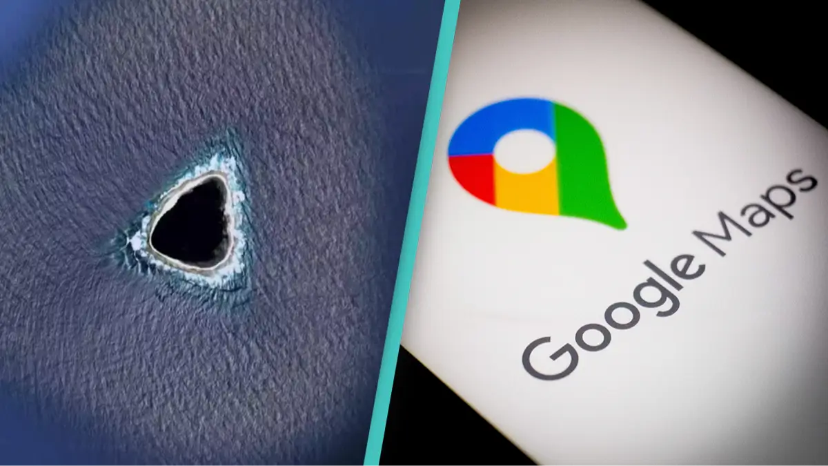
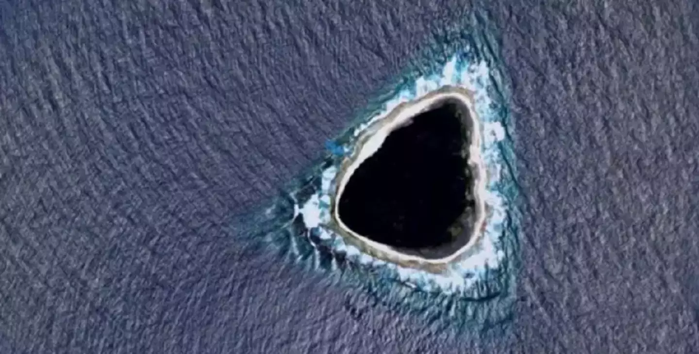
Nobody has been able to work out exactly where in the world it is - and technically, it's not even an island.
It's known as an atoll, which usually consists of a lot of reef.
Outside the island, you can see the lovely blue ocean, and presumably some small beaches. Despite this, the centre of the island is completely blacked out.
Google Maps often use this feature for places they do not have access to, or if people have specifically requested not to be on maps.
It could also be that they genuinely forgot - which would be quite bizarre.
But the internet has some pretty ridiculous takes on what it could be. One person wrote: "God dropped his guitar pick."
Which, whilst quite funny, is probably easy to rule out.
Another said: "My first thought was that it's censored. It wouldn't make sense for a natural formation to be black like that in such a shallow, small atoll/island."
This could be our answer.
A third even joked: "Ladies and gentlemen, they have found the Island in Lost."
However, one Reddit user might have really hit the nail on the head.
They said: "OK so the real answer is the blue colour around the island is a painted-in color so the oceans look uniform in the maps. Islands are added by erasing some of that blue to let the satellite image show through.
"Sometimes they do a sloppy job. So what you are seeing moving inward is: artificial ocean colour, real ocean with waves, beach, island.
"As for the shape, idk man islands come in all shapes and sizes I don't discriminate".
Whatever it is, best believe one wildly inquisitive person will be booking the next flight there.
Topics: Google Maps, World News