Experts issue warning as 'Super El Niño' forming at rapid rate could have dangerous global impact
New forecasts have shown that a ‘Super’ El Niño is developing in the tropical Pacific Ocean and could be one of the strongest on record.
According to data by the National Oceanographic and Atmospheric Administration (NOAA), things are heating up in the Pacific, with 2027 likely to become the warmest year on record, as its researchers suggest the El Niño will begin within the month.
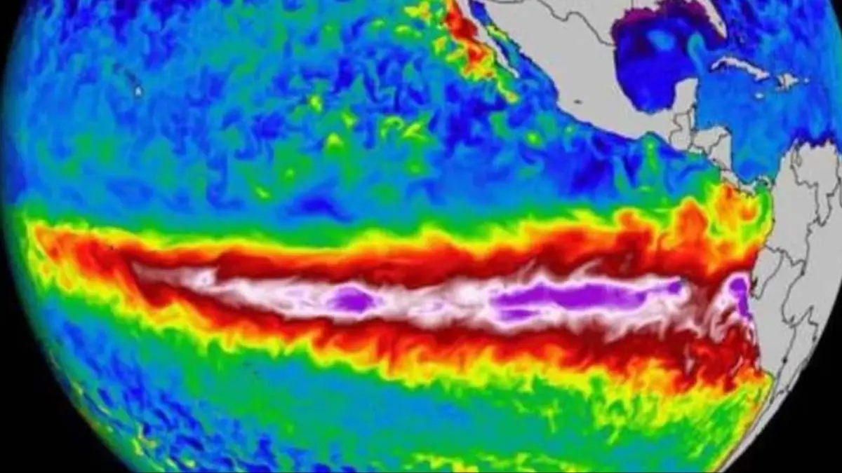
If you’re not sure what an El Niño is, aside from being the Spanish translation of ‘the boy’, it’s when the area across the tropical Pacific’s sea surface experiences a spike in temperature.
A 'super El Niño' is when the temperature in a stretch of the tropical Pacific ocean dubbed the Niño3.4 rises by more than 2.7°F, according to the BBC.
Advert
However, what’s truly scary is that forecasts from the European Centre for Medium Range Weather Forecasts (ECMWF) believe the expected super El Niño will cause a temperature increase of 4.5°F by Fall.
But what does that mean for you?
The latest federal forecast says the El Niño officially has an 82 percent chance of starting by at least July, per the Climate Prediction Center, and according to expert Zeke Hausfather, it could be ‘among the strongest El Niños in recent history’, per USA Today.
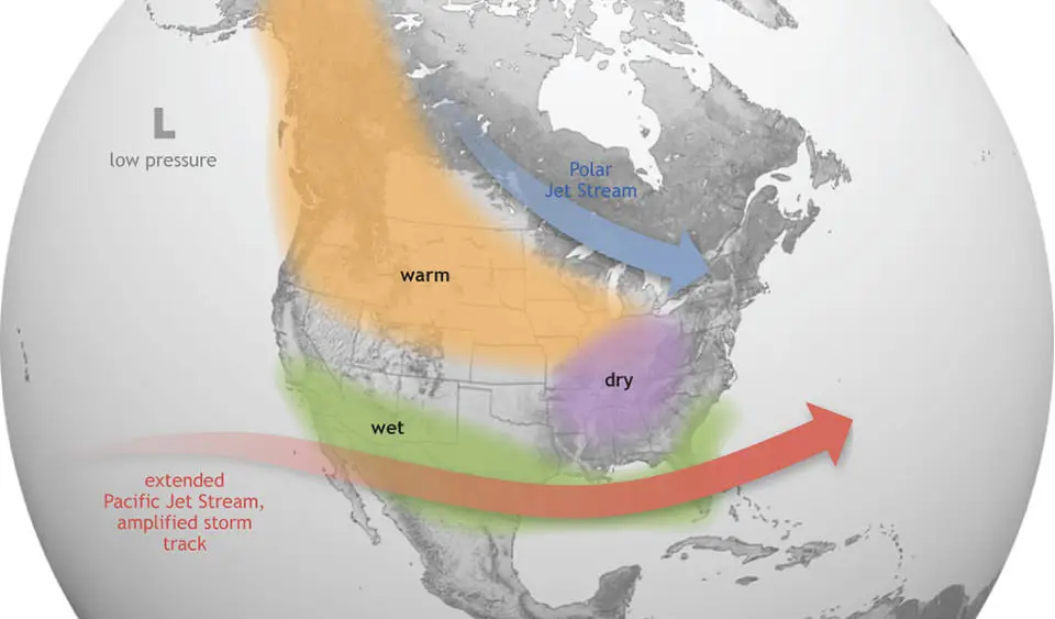
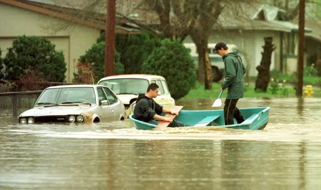
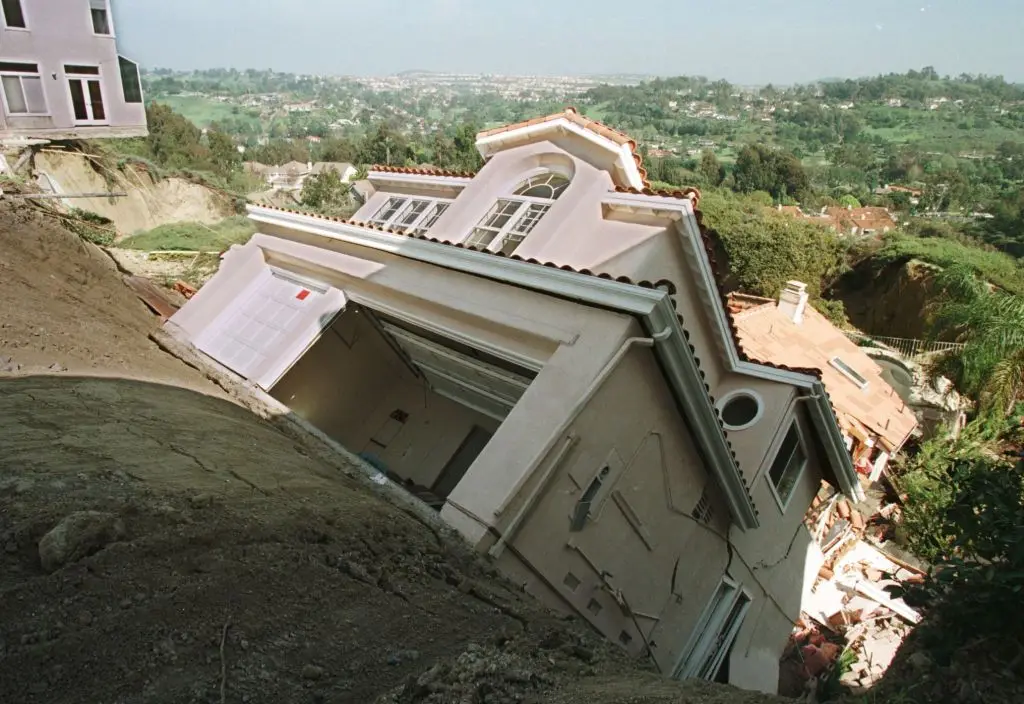
When the Pacific water changes temperatures, it can impact the weather, so when there’s an extreme increase, it can influence things like droughts, wildfires and flooding.
It also has a hand to play in the number of hurricanes in the Atlantic and Pacific oceans, and it can even lead to storms and flash flooding in parts of the US, such as the West and South.
As for the Plains, across to the Ohio Valley, this is particularly a concern, Paul Pastelok, AccuWeather’s lead long-range expert told the outlet.
He went on to say: “Drought and wildfire risk will also be major concerns in the Northwest.”
Another issue the El Niño could bring is its influence on hurricane season from May 15 in the Eastern Pacific and June 1 in the Atlantic, with it being able to suppress hurricanes in the Atlantic basin, whilst making them stronger in the warmer Pacific.
This isn't the first time an El Niño has taken place throughout history, with one terrifying event occurring between 1997-1998.
According to The Guardian, this instance killed 23,000 people and caused billions in damage.
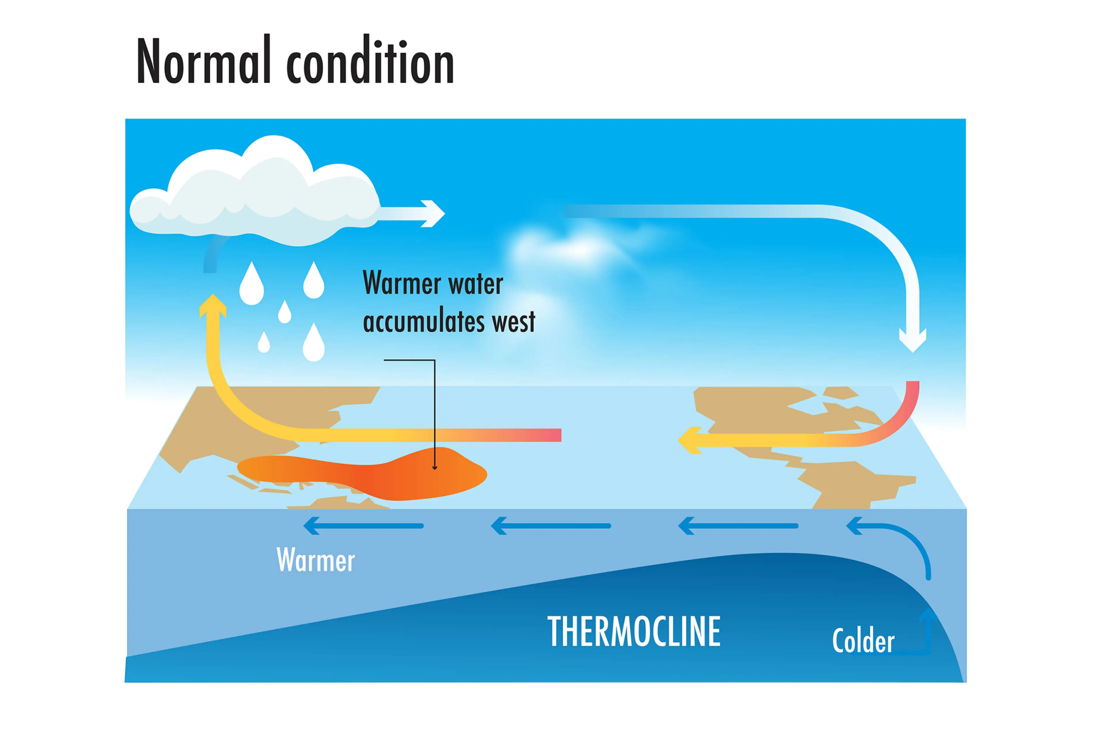
How does an El Niño year happen?
Strap in, folks. It’s time for some science.
It all starts with something called trade winds, which are permanent winds around the equator, which usually blow from east to west. So in the equatorial Pacific, they blow from the Americas towards Australia and New Zealand.
As the wind blows the water east, it is warmed by the sun, so by the time it gets to the other side of the Pacific, the warm water causes hot air to rise, leading to warm, wet and unsettled weather. Meanwhile, colder water from deeper in the ocean rises in the east to replace the water blown west.
But during El Niño years, this gets disrupted.
Trade winds are weakened or even reversed, the temperature difference between the east and west is cancelled out, and usually cold parts of the ocean warm up.
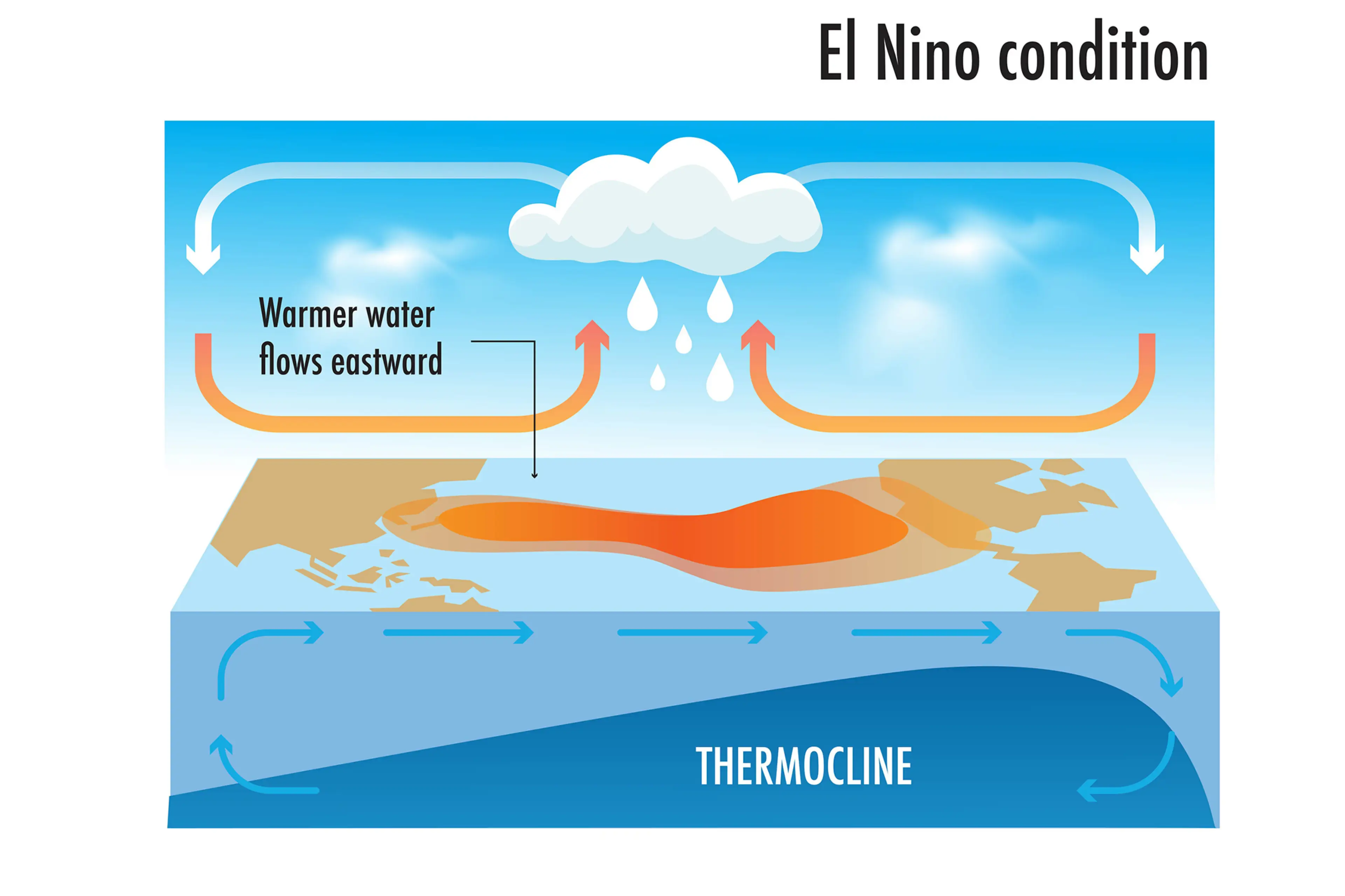
Rainfall and wind patterns change across the equatorial Pacific, which has a knock-on effect around the world.
Anyone else's head hurt a bit?
 Britt Jones