Millions of Americans across seven states are being urged to prepare for the threat of Hurricane Erin as the tropical storm heads towards the mainland.
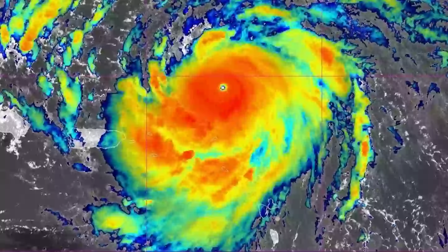
The storm is moving northwest at 13 mph with maximum sustained winds of 130 mph in what is the first Atlantic Ocean storm of the season.
Erin briefly intensified to Category 5 status on Saturday (August 16), which could bring life-threatening conditions and dangerous rip currents; however, while it reached Category 3, it is still expected to bring some damage (via NBC News).
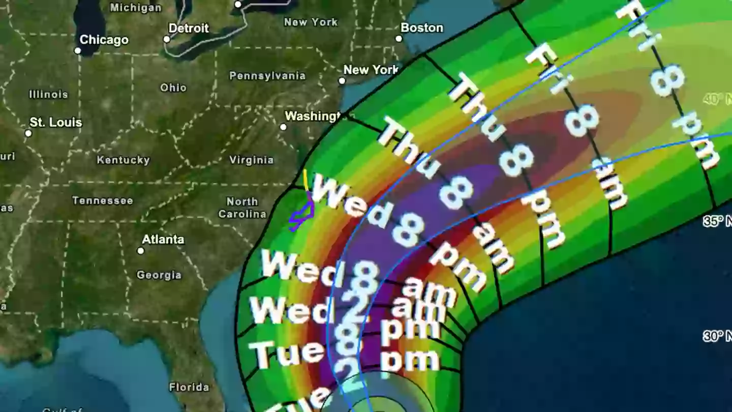
Now, North Carolina officials have declared a state of emergency and ordered mandatory evacuations for multiple coastal areas.
Advert
Flood warnings are also in effect for parts of South Carolina, Georgia, Virginia, New Jersey, New York and Massachusetts.
While Erin is not expected to make landfall, the storm is set to generate massive 20-foot waves and dangerous rip currents along the East Coast, despite being around 200 miles offshore.
Thanks to the use of satellite data by scientists, forecasters estimate winds of about 115 mph - though the National Hurricane Center are expressing some caution surrounding this number.
Advert
"There are mixed signals on Erin's future intensity," the NHC said (via The Daily Mail). "More favorable environmental shear and upper-level divergence in 24–36 hours could allow some re-intensification, but Erin's slow motion and large size may bring cooler water to the surface, limiting significant strengthening."
Through Thursday (August 20), the storm is expected to affect the Tri-State Area, mainly targeting the Jersey Shore and Long Island's South Shore.
Hyde County has also declared an emergency for Ocracoke Island, with visitor and resident evacuations having already taken place.
Donnie Shumate, Hyde County Public Information Officer, said in a press release: "While Hurricane Erin is expected to stay well off our coast, the system will continue to increase in size and is forecast to bring life-threatening impacts to the Ocracoke coastline and render Highway 12 impassable."
Advert
While the storm may have weakened in recent hours, the NHC say Erin will remain 'dangerous' throughout the middle of the week, so it's important to listen to the advice provided by local government.

"Even though some weakening is forecast beginning Monday night, Erin will remain a large and dangerous major hurricane through the middle of the week," they added.
On top of the US, the Bahamas government has issued a Tropical Storm Watch for the central Bahamas, while warnings are still in place for the Turks and Caicos Islands and southeast Bahamas.
Advert
Dare County in North Carolina has evacuated most of its 38,000 residents, with Drew Pearson, the emergency management director, issuing a pretty clear message to people in the area.
"I encourage all residents and visitors to heed the evacuation order and take action to protect themselves, to protect their property, and to get up and leave — now," he said.
Topics: US News